Subjects





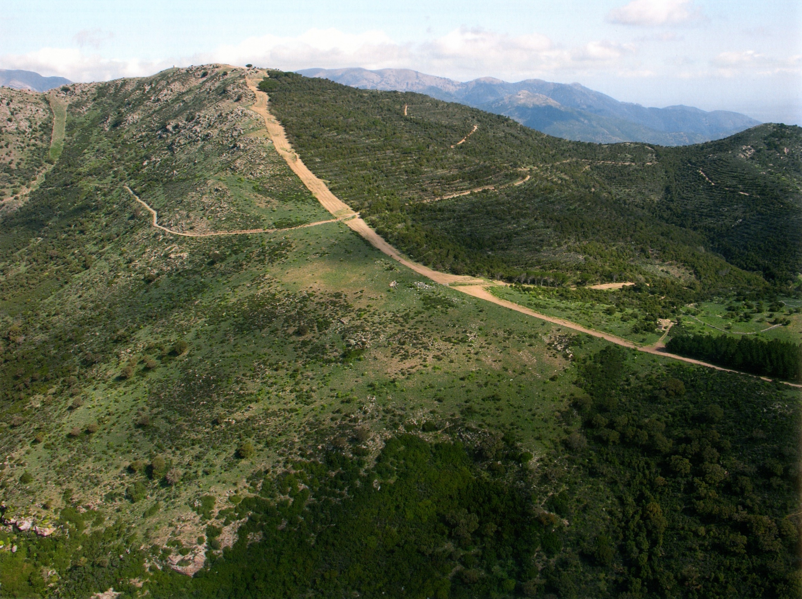
The archaeological area of Santa Cristina is located in the basalt plateau of Abbasanta, in central-western Sardinia, near the rural sanctuary of Santa Cristina and constitutes one of the most important sacred areas of nuragic Sardinia, and one of the most significant examples of a sanctuary dedicated to the cult of water.
The complex includes two sectors, to the northeast and to the southwest, separated from the church with its' cumbessias', not earlier than the 18th century.
The northeastern core includes the well temple, the so-called 'meeting hut' with an adjoining enclosure and a series of other rooms.
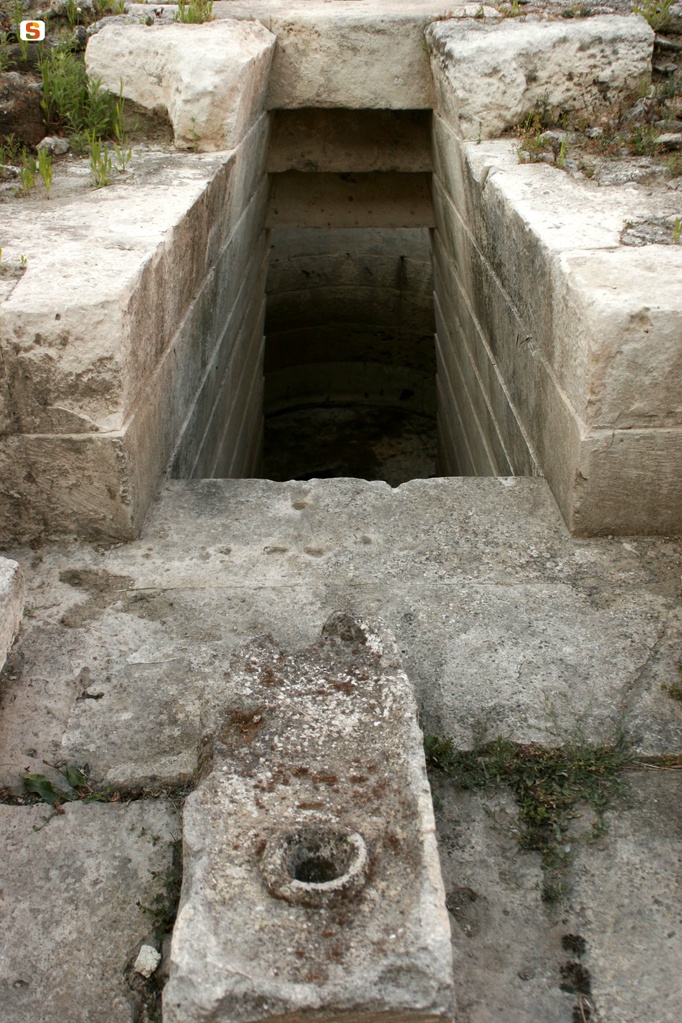
The well temple consists of an atrium, a descending staircase and an underground tholos that guards the spring vein. Even today, spring water filters through the interstices of the chamber walls, which is particularly abundant in winter-spring.
Of the height of the well, only the plant profile remains, which, however, does not seem to fully reflect the original design. The upper-middle part of the staircase has been completely restored.
The emerging structures, limited to the perimeter wall shaped like a key lock with a counter seat (perhaps later), include the rectangular atrium and the well drum. Everything is enclosed by an elliptical enclosure with an entrance facing north, northwest, which separates the temple from the other structures of the sanctuary. The elliptical enclosure originally had to support an earthen mound in which the entrance to the staircase was framed, probably monumental as can be seen in the contemporary temple of Su Tempiesu di Orune, in excellent condition and recently restored.
The stairwell, with its plan and trapezoidal section, has a total depth of about 6.50 meters. The staircase consists of 25 steps and is covered by a stepped ceiling that reproduces a sort of inverted staircase. The tholos, very tapered, is masterfully built with rows of medium-sized basaltic blocks with a blurred face. The uppermost ring has no clasp.
The “meeting hut”, where presumably the meetings of the heads of the Nuragic communities who went to the sanctuary for the celebration of common rituals took place, located west of the temple, is circular. The interior is paved with pebbles and has an annular seat.
Close to the room there are rooms with a square, rectangular and circular plan, which advance a few rows, to be interpreted as lodgings for cult workers and pilgrims and as shops connected to the market that was to be held on the occasion of religious solemnities.
The excavations of the temple have revealed Syro-Palestinian bronzes from the end of the 2nd to the beginning of the 1st millennium BC and simple arched bronze fibulae and leeches from the 9th and 7th centuries BC, which testify to the commercial vitality of the sacred area. The bronze spaceship reported by Taramelli was instead connected to the temple's favissa.
The sacred well is probably to be placed in the final Bronze Age, probably in the eleventh century BC. In the late Punic age the sanctuary was dedicated to Demeter and Core, as evidenced by the fictilian ex-vota with the “kernophoros” goddess and the cloaked female figures, and in the late republican age to Ceres.
The south-west sector, about 200 m from the previous one, has a nuraghe and housing structures of various chronology.
The nuraghe is a single-tower with a staircase and an entrance niche. It is built with freshly drafted basalt blocks. The room has three niches arranged in a cross shape and still has the ogival vault intact.
Around the nuraghe there are traces of the town, in particular three elongated huts of uncertain chronology.
History of excavations
The archaeological site was recognized in the nineteenth century by Alberto Lamarmora and Giovanni Spano. Antonio Taramelli reported the discovery of a Nuragic spacecraft, but the first excavation of the well dates back to 1953. Other investigations were carried out in 1967-73 and 1977-83 by Enrico Atzeni. In 1989-90 Paolo Bernardini explored some environments in the village. The area is still being excavated and restored.
Bibliography
E. Atzeni, "Santuario nuragico di Santa Cristina (Paulilatino), in Rivista di Scienze Preistoriche, XXXII, n. 1- 2, 1977, p. 359;
E. Contu, "L'architettura nuragica", in Ichnussa. La Sardegna dalle origini all'età classica, Milano, Scheiwiller, 1981;
G. Lilliu, La civiltà dei sardi dal paleolitico all'età dei nuraghi, Torino, Nuova ERI, 1988;
A. Moravetti, Il santuario nuragico di Santa Cristina, collana "Sardegna archeologica. Guide e Itinerari", Sassari, Carlo Delfino, 2003;
R. Zucca, Viaggio nell'archeologia della provincia di Oristano, Oristano, E.P.T. Oristano, 2004, pp. 35-36.
How to get there
The archaeological area can be reached from the SS 131 Sassari-Cagliari: at the height of 114.300 km there is the junction, marked by signs, to reach the complex.
Structure category: archaeological area or park
Content type:
Archaeological complex
Archaeology
Usability: Open
Province: Oristano
Common: Paulilatino
Macro Territorial Area: Central Sardinia
POSTAL CODE: 09070
Address: SS 131, km 114,300
Telephone: +39 0785 55438 +39 347 7746747
E-mail: info@pozzosantacristina.com archeo.amministrazione@gmail.com
Website: www.pozzosantacristina.com
Facebook: www.facebook.com/pozzosantacristina
Information on tickets and access: For updated information on schedules, ticket costs and online purchases, it is recommended to visit the structure's dedicated web page. The entrance ticket purchased at the Archaeological Area of Santa Cristina, or online, also allows access to the “Palazzo Atzori” Ethnographic Museum in PauliLatino.
Access mode: For a fee
Services information: It is advisable to call to confirm that the guided tour service is being carried out during the lunch break. The first guided tour starts at 8:30 and then the others: 9:30 - 10:30 - 11:30 - 12:30 etc. until sunset; in summer the last guided tour starts at 19:30. As a minimum time, guided tours are always guaranteed in the morning and in the afternoon immediately after the lunch break.
Update
Services
 Audiooguide
 Guided tours
Where is it
Paulilatino, complesso nuragico di Santa Cristina Images number: 17
Video


 Facebook
 Twitter
 LinkedIn
 Whatsapp

 Print
Print
 E-mail


Comments