Subjects





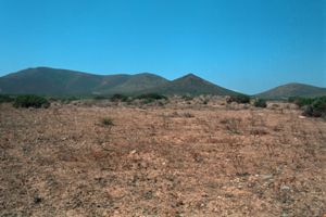
The necropolis is located on the S ridge of Pianu Oschiri, a volcanic plateau on the border between the Goceanarium and the Logudoro. Below it flows the Tuvu 'e Carru river.
The necropolis consists of 18 domus de janas, excavated on three overlapping horizontal levels starting from the basal line of the ridge, for a maximum height of m 3 above the country level.
The materials found during the excavations have made it possible to date the burials to a period between the final Neolithic (culture of Saint Michael, 3200-2800 BC) and the ancient Bronze Age (culture of Bonnanaro, 1800-1600 BC).
The tombs were accessible thanks to notches or pedaloles engraved in the rock leap, while an accurate system of channels channeled rainwater and infiltration water down and to the sides of the tombs, preserving decorations, bodies and funeral equipment from humidity and degradation. The entrances were closed with wooden or stone doors.
The burials are of the horizontal projection type and have simple planimetric systems (single-celled, bicellular, “T-shaped”) or multicellular. Multicellular tombs have an anticell that generally precedes a compartment on which the lateral cells are placed. The cells had a funerary function, while in the anticell cults and funeral rituals were practiced, as attested by the dimples dug in the floor intended to contain liquid and solid offerings.
Tomb IX (also called “sa tumba de su re”) stands out clearly from the others due to the presence on the façade of a hunched stele of the type found in the tombs of giants.
The Sos Furrighesos star (m 4.05 in h, m 4.02 in width) It is divided into two boxes well cut out with a chisel. The upper frame is shaped like a bezel, the lower one is shaped like a trapezoid; one is separated from the other by a shaped and detected horizontal strip. The band surrounding the stele laterally and upwards has the same relief.
Above the stele, three cavities are dug where there are three betyl pillars without the terminal part. They had magical-protective functions.
The stele was sculpted after the excavation of the hypogeum, in ancient bronze, using the space of a previous anticell.
The interiors of the domus are rich in architectural elements that reproduce the terrestrial home: ceilings (with one or two sloping ceilings), plinths, relief bands, columns, pillars, pilasters, beds, dividing panels, fireboxes.
The decorations and symbols of Neolithic religiosity abound, especially in the anticles and in the main cells: painting in red ochre (the color of blood, life and regeneration); the motif of the false door that symbolizes the entrance to the underworld; the horns and bullfighting protomes rendered in bas-relief and colored in red or engraved, typical expressions of the cult of the bull god.
Of particular interest is the decorative score of the S wall of the main cell of Tomb II. Obtained with deep incisions, it consists of a false central door, two side panels, two parallel upper bands, a base plinth and a pilaster on the far right. False door and bands are painted red.
Tombs II, VIII, IX, XI, XII have returned 140 petroglyphs made with hammerhead, linear engraving and dotted techniques. There are corniform, anchoriform, anthropomorphic, pettiniform figurations, animal figures, weapons and geometric patterns (circle, polygon, lattice, segment, star, triangle, zigzag). The hammerhead engravings are dated to the ancient Chalcolithic-Bronze (2800-1600 BC).
The excavations of the necropolis have also revealed levels of attendance from the Roman and early medieval ages.
History of excavations
The tombs were excavated in the 70s of the twentieth century by Giuseppa Tanda and returned the highest concentration of pre-Nuragic petroglyphs and artistic figurations on the island.
Bibliography
E. Contu, “Notiziario Sardegna”, in Rivista di Studi Preistorici, XXV, 1970, p. 432;
G. Tanda, Art and Religion of Prehistoric Sardinia in the Sos Furrighesos Necropolis, Sassari, Chiarella, 1984.
How to get there
Take the SS 131 128 bis, after about 6 km you arrive at Mores. After passing the town, after about 1 km, you turn right up the road to Bono. After 11.5 km, take the junction for Nughedu San Nicolò upwards. Soon after, you can see the first tourist sign for the archaeological site. Follow the provincial road to Nughedu for 6.2 km until you find a second sign that indicates the direction of the necropolis. About 200 m before this sign, take the white road that leads to an agritourism farm where you can get the last signs to reach the tombs.
Content type:
Archaeological complex
Archaeology
Usability: unmanaged site
Province: Sassari
Common: Anela
Macro Territorial Area: Nord Sardegna
POSTAL CODE: 07010
Address: località Sos Furrighesos
Update
Where is it
Video
Audio


 Facebook
 Twitter
 LinkedIn
 Whatsapp

 Print
Print
 E-mail



Comments