Subjects





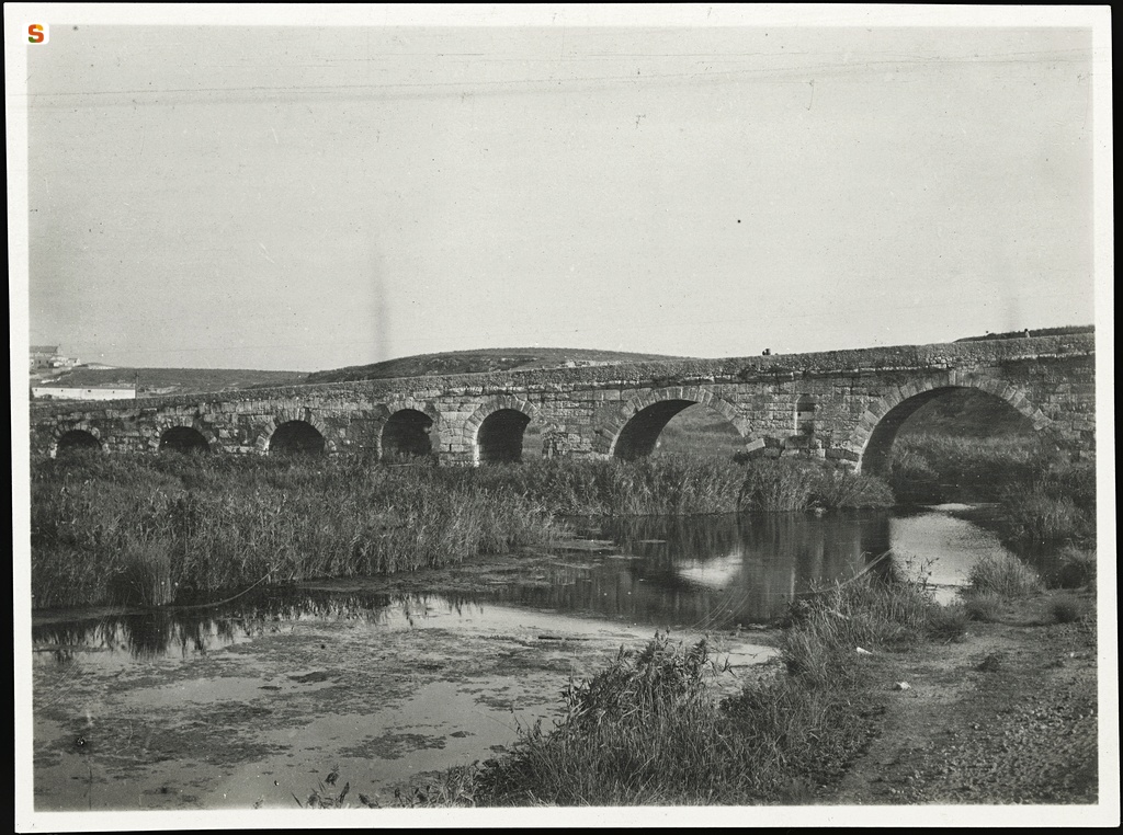
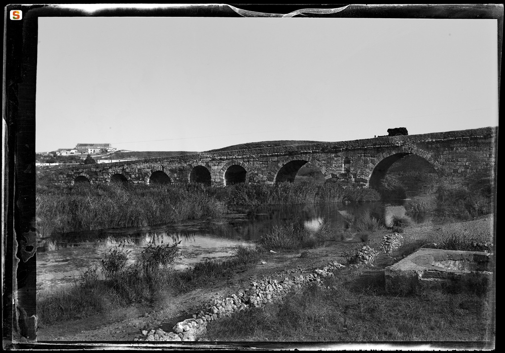
The city of Roman colonial foundation was located on the site of the current Porto Torres, near the mouth of the Mannu River, in the center of the Gulf of Asinara, in northern Sardinia.
Turris Libisonis developed in a geographical and environmentally favorable stretch of the coast, with landings and the possibility of installing a river port on the Mannu River.
The area does not seem affected by a previous Phoenician-Punic presence. However, the landscape, at the time of the founding of the Roman colony, in the first century BC, must show an older settlement system, given the high concentration, among the highest on the island, of nuraghi along the coast and in the immediate hinterland. The very name of the city seems to echo the presence in the landscape of a pre-existing element visible at the time of colonial deduction, namely a nuraghe.
The colony, the only Roman citizen of the province “Sardinia”, bears the appellation of “Iulia”: for this reason, its deduction is attributed to Cesare, who stayed in Sardinia in 46 BC, or to Ottaviano, after the victory of Filippi, in 42 BC.
The data for a reconstruction of the urban form are not many, but sufficient to hypothesize a first settlement on the Mannu River, located on both banks, according to the model of the port-canal that was quite widespread in the republican age and at the beginning of the imperial period.
Between the end of the Republican Age and the Augustean Age, the city was equipped with the main road and port infrastructures, an aqueduct and perhaps a first thermal system (first phase of the “central baths”?) , taking on fully Roman urban and architectural connotations.
For the first imperial age, residential neighborhoods are attested in the area where the “Maetzke baths” will be located and at the Turritano Antiquarium. The location of the forum remains uncertain and the hypotheses put forward so far (at the current Piazza Umberto I or in correspondence with the “Pallottine peristyle”) need confirmation.
Between the middle of the 1st and the middle of the 2nd century AD, a basin for collecting water ('lacus') and perhaps the 'Maetzke therms' were built, and the 'central baths' were affected by a second building phase.
Between the end of the 2nd and 3rd century AD, the city prospered with maritime traffic, the internal economy of cereal and livestock, fishing, mining and craftsmanship. The town was reorganized near the new port, perhaps near the current dock; here were built the warehouse or “horreum” (Corso Vittorio Emanuele II) and another building (near the Bank of Sardinia) probably linked to port activities.
The maintenance and strengthening of the port were the main interests of the administration of the colony, which traded directly with the port of Ostia. An official was in charge of managing the river port ('procurator ripae'), while the Turritan seafaring is attested by the inscription of a mosaic of the Ostia forum ('navicularii turritani').
Between the 3rd and the beginning of the 4th century AD, building activity intensified with the construction of buildings that are still appreciable today in the archaeological area and can also be documented through conspicuous remains of marble decorations, bas-reliefs and statues. Some inscriptions recall the construction or restoration of buildings, such as the restoration of the temple of Fortune and the basilica with the court (not yet identified) on the initiative of the governor Marco Ulpio Vittore in 244 AD. This period also dates back
to the construction of the stretch of walls along the banks of the river Mannu, the last phase of the “central baths” and probably the “Pallottino baths”.
Between the end of the 3rd and the beginning of the 4th century AD, the city hosted the provincial judicial sessions (“conventus”) and the governor of the island himself, for a few months a year: this is attested by the aforementioned inscription relating to the temple of Fortune, by the dedication of the governor Valerio Domiziano, in 305 AD, in honor of Galerius Caesar and by the dedication to Licinio Augustus by the governor Titus Septimius Januarius, between 312 and 319 AD. Urban growth stopped between the end of the 4th and the beginning of the 5th century A.D. .
The real extent of the city is unknown, but the location of the necropolises can provide points of reference. Three burial areas have been identified: the western necropolis (or Marinella) on the left bank of the Mannu river, the southern one (or Monte Agellu) extended below the current city center and the eastern one that extends into the waterfront and which includes the hypogeum of Tanca Borgona, the funerary complex of Scogliolungo, the tombs of Balai and the hypogeic complex of San Gavino a mare.
In light of these considerations, an extension of the city to the area of the current center (Corso Vittorio Emanuele II, an area below the National Labor Bank and near Piazza Umberto I) seems unlikely, except for some points where excavations have revealed overlapping housing structures and warehouses that are often covered by burials. It is likely that the development of these peripheral areas refers to the time of the city's maximum expansion, in the Severan age (3rd century AD).
History of the excavations
The first investigations were conducted in 1614 by Archbishop Gavino Manca di Cedrelles and involved the interior of the Basilica of San Gavino. In 1819, Brother Antonio Cano dug in the area of the “thermal baths”, using gunpowder and destroying entire sectors. Most of the subsequent archaeological discoveries are due to landfilling activities during public utility works: the construction of the railroad (1872) and the aqueduct (1882), the expansion of the railroad (1924-1928). Over the last fifty years, with good results, the Archaeological Superintendence has introduced modern excavation methods, and has operated, often in emergency situations, compatible with the development needs of the modern city. Between the 1940s and the 60s, Massimo Pallottino and Guglielmo Maetzke brought to light thermal baths, public buildings, residential and productive districts. From the 70s to today, residential and productive areas located below the city center and, above all, cemeteries have been investigated. Excavations are currently being carried out along the course of the Mannu River, near the Colle del Faro, relating to a building that is most likely a villa.
Bibliography
A. Boninu-M. Le Glay-A. Mastino, Turris Libisonis colonia Iulia, Sassari, Gallizzi, 1984, pp. 105-116;
F. Villedieu, Turris Libisonis. Fouille d'un site romain tardif à Porto Torres, Sardaigne, collana "International Series", 224, Oxford, BAR, 1984;
A. Boninu, "Turris Libisonis. La città romana", in Il Museo Sanna in Sassari, a cura di F. Lo Schiavo, Sassari, Banco di Sardegna, 1986, pp. 255-256;
F. Manconi, "L'Antiquarium Turritano", in Il Museo Sanna in Sassari, a cura di F. Lo Schiavo, Sassari, Banco di Sardegna, 1986, pp. 263-286;
A. Mastino, "Turris Libisonis romana", in Porto Torres e il suo volto, Sassari, Carlo Delfino, 1992, pp. 5-74;
A. Mastino - C. Vismara, Turris Libisonis. Sassari, C. Delfino, 1994 (Sardegna archeologica. Guide e itinerari; 23);
D. Rovina, "Turris Libisonis: strutture romane e altomedievali nell'area della sede del Banco di Sardegna", in Materiali per una topografia urbana: status quaestionis e nuove acquisizioni. Atti del V convegno sull''archeologia tardoromana e altomedievale in Sardegna, Oristano, S'Alvure, 1995, pp. 145-158;
M.C. Satta, "Nuovi contributi per una topografia urbana di Turris Libisonis: strutture termali e sepolture nel Corso Vittorio Emanuele", in Materiali per una topografia urbana: status quaestionis e nuove acquisizioni. Atti del V convegno sull''archeologia tardoromana e altomedievale in Sardegna, Oristano, S'Alvure, 1995, pp. 159-191;
C. Cazzona, "Nota sulla fondazione della colonia di Turris Libisonis: Iulii, Flavii, Aelii, Aurelii, e Lurii nelle iscrizioni", in Studi Sardi, XXXI, 1994-98, pp. 253-277;
G. Azzena, "Porto Torres. Turris Libisonis, la città romana", in Luoghi e tradizioni d'Italia. Sardegna, Roma, Editalia, 2000, pp. 368-380;
M.C. Satta, L'Acquedotto Romano della colonia di Turris Libisonis, Piedimonte Matese, Imago Media, 2000;
G. Manca di Mores, "Nuovi scavi e tecnologie avanzate nel centro storico di Porto Torres", in L'Africa Romana. Atti del XIV convegno di studio, Roma, Carocci, 2002, pp. 1151-1158;
A.R. Ghiotto, L'architettura romana nelle città della Sardegna, Roma, Quasar, 2004, pp. 195-197;
A. Mastino, Storia della Sardegna antica, Nuoro, Il Maestrale, 2005, pp. 273-283.
Update
Images
Video


 Facebook
 Twitter
 LinkedIn
 Whatsapp

 Print
Print
 E-mail



Comments