Subjects





The toponym of the area, and consequently of the tower, takes its name from the mouth of the Mannu River. The area was then defined as Rio Foghe, Rio Foghedoglia, Fogudolla, Fogo D'Oglia, Fogudoglia, Foguedolla, etc.
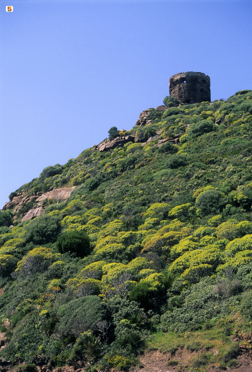
Located 70 m above sea level, the Foghe tower had a field of vision of 30 km and was in optical contact with the towers of Capo D'Ischia and Capo Nieddu. The fort dominated the access to the Mannu River, a possible water supply for Barbary pirates.
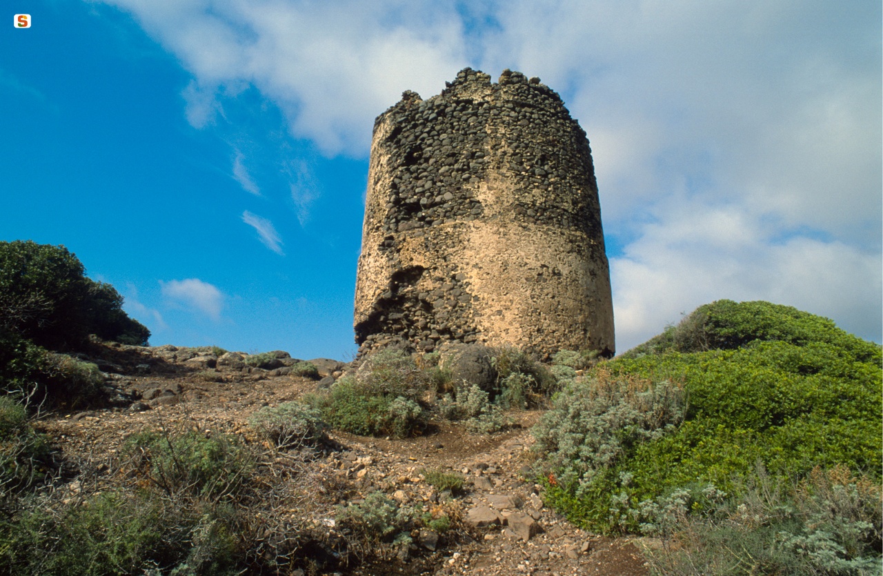
The tower consists of two cylindrical bodies of almost identical diameter; the attachment of the second structure is located at a third of the height. The diameter at the base of the tower is 8.6 m and the height is 9.6 m. Inside there is a circular chamber turned like a dome, without loopholes, with an internal fireplace; the only opening is the hatch, located at a height of 4 m above the ground. On the side of the entrance, a staircase, carved into the thick wall, allows access to the outdoor terrace or parade ground. The material with which the tower was made comes from the area; basalt rocks were used for the structure, while the arch and jambs of the hatch are made of red vulcanite.
The tower was probably built between 1580 and 1590, as it appears in Giovanni Francesco Fara's report on the towers that existed before 1591. Previously, according to the report of the captain of Iglesias, Marco Antonio Camos, who had carried out a census of the coast of Sardinia and of the sites most frequented by privateers, there was a guard post at the mouth of the river consisting of two men paid by the corallari of Bosa.
In 1604, the first repair work is documented. Other restoration works are attested in 1720, such as the plastering of the walls and terrace and the rearrangement of the garittes and the crescent.
From a 1729 report, the tower is defined as “de Armas”, of heavy defense; on the other hand, according to the Ripol report of 1767, the fortress would function as a signal tower, since, according to the Piedmontese speaker, the garrison present in the fortress consisting only of the warden (the captain of the tower), two soldiers and an arsenal, consisting of a single cannon and a shotgun.
In the same year, a new restoration of the Foghe tower and that of Argentinas was planned by the colonel of the De Brondel towers; in 1784 other repairs were carried out and in 1833 it was renovated again, together with the towers of Ischia Ruja and Columbargia.
In 1842, the Royal Administration of the Towers was suppressed and the following year it was disbanded. Currently, the parapet of the Piazza d'Armi has collapsed and, on the left side of the entrance, the masonry has a conspicuous lesion with the subsidence of the stone.
Bibliography
E. Pillosu, The Coastal Towers in Sardinia, Cagliari, Tipography La Cartotecnica, 1957;
F. Fois, Spanish Towers and Piedmontese Forts in Sardinia, Cagliari, La Voce Sarda, 1981;
G. Montaldo, The Coastal Towers in Sardinia, Sassari, Carlo Delfino, Sassari 1992;
F. Russo, The Coastal Defense of the Kingdom of Sardinia from the 16th to the 19th Century, Rome, Army General Staff, Historical Office, 1992; G. Montaldo, “Forts and Coastal Towers”, in The Architectures
fortified buildings in central-southern Sardinia. Proceedings of the Study Day, Cagliari October 16, 1999;
M. Rassu, Guide to coastal towers and forts, Cagliari, Artigianarte, Cagliari 2000.
How to get to
Tresnuraghes can be reached from Macomer via the SS 129 bis or from Oristano via the SS 292. Once you arrive at the town, take the road that runs along the Mannu River to the sea, for 11 km; at the end, you reach the promontory of Punta Foghe, on which the tower stands.
Content type:
Fortified architecture
Province: Oristano
Common: Tresnuraghes
Macro Territorial Area: Central Sardinia
POSTAL CODE: 09079
Address: strada Torre Foghe - località Punta Foghe
Update
Where is it
Tresnuraghes, Torre Foghe Images number: 3


 Facebook
 Twitter
 LinkedIn
 Whatsapp

 Print
Print
 E-mail


Comments