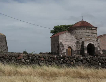
The archaeological area, which also includes the medieval church of Santa Sabina (Santa Sarbana), is located in the Silanus plain, in the Marghine, a region of central-northern Sardinia.
The complex consists of a nuraghe, a village, a tomb of giants and a sacred well. The presence of the church of Santa Sabina (from medieval times but still a destination of popular devotion) documents the contiguity of testimonies from different periods and the persistence of the sacredness of the place from ancient times to today.
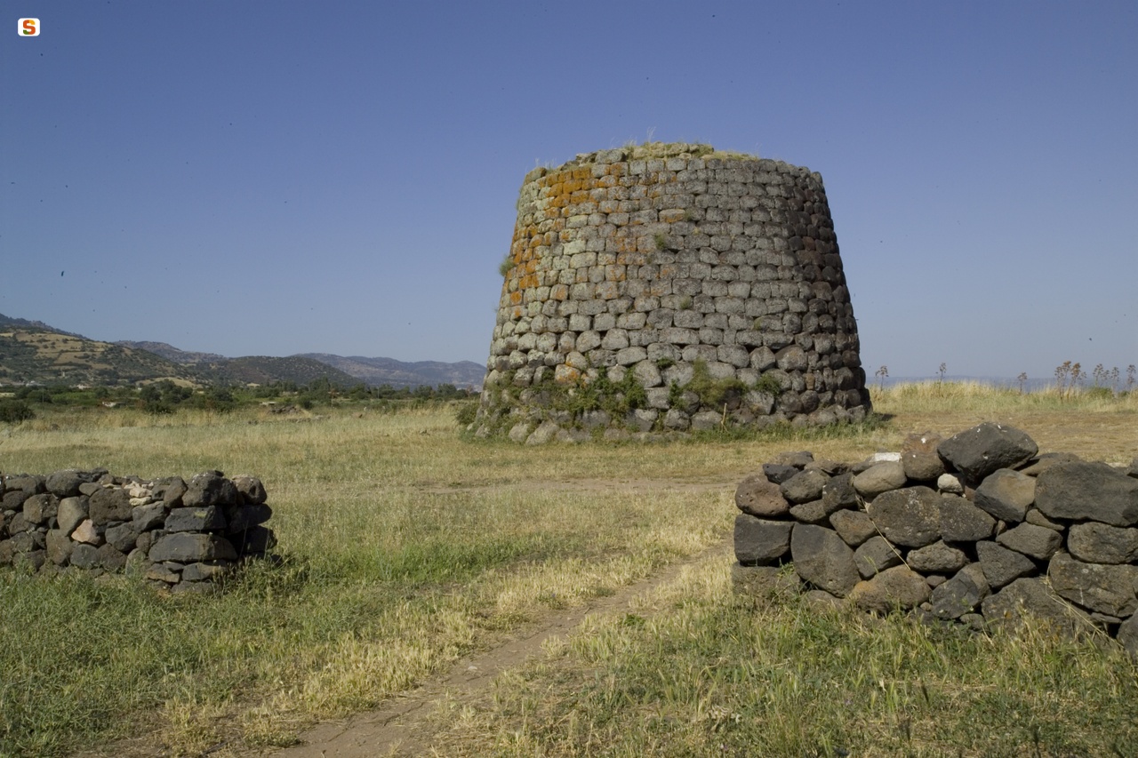
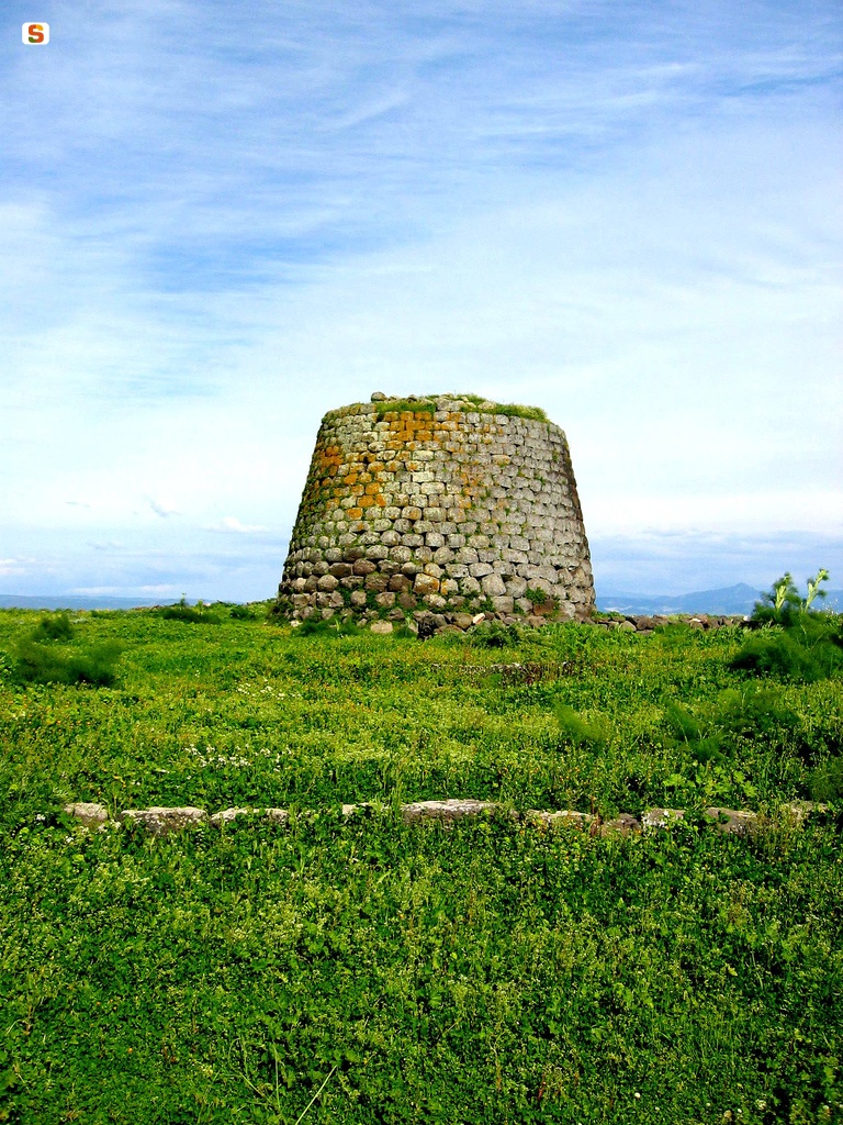
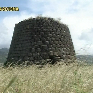
The nuraghe, a monotorre (diameter 12.60 m; remaining height 8.60 m), is made of large basalt blocks, finished with greater care in the upper parts of the wall. The entrance, oriented to the south (width m 1.20; height m 1.82), leads into a corridor (width m 1.20; length m 5.00) with a ceiling sloping towards the entrance to the room and with overhanging walls. In the right wall of the corridor, there is a sub-rectangular opening niche with an arched trapezoidal door, while on the left is the stairwell, with an arched trapezoidal entrance (width m 1.05, height m 2.37) and an ogival section (average width of m 1.00, height of m 3.88); the staircase can be traveled to the current top of the tower and has a rectangular opening (m 0.30 x m 0.36). The corridor leads into the central chamber, with a circular plan (diameter 4.15 m), which preserves the oiled roof (height 8.35 m) and three wall niches arranged in a cross.
The nuraghe dates back to 1600-1000 BC.
In the area in front of the nuraghe and near the church of Santa Sabina, the traces of the nuragic village can be identified, consisting of circular huts. The town was reused in Roman times.
History of excavations
The nuraghe was recently excavated by the Superintendence for Archaeological Heritage of the provinces of Sassari and Nuoro.
Bibliography
V. Angius in G. Casalis, Geographical, Historical, Statistical, Commercial Dictionary of the States of His Majesty the King of Sardinia, XX, 1850, p. 138;
Ministry of Education, List of Monumental Buildings, Rome, Tip. Operaia Romana Cooperativa, 69, 1922, p. 157;
A. Taramelli, “Sheet 205 (Capo Mannu)”, “Sheet 206 (Macomer)”, in Archaeological Edition of the Charter of Italy, Florence, Military Geographic Institute, 1935, p. 12, n. 24, p. 13, n. 24a, 25;
C. Zervos, The Civilisation of Sardaigne, du début de l'énéolithique à la fin de la période nouragique: 2. millenaire, 5. siecle avant notre ere, Paris, Cahiers d'art, 1954 (Italian edition: Sassari, Carlo Delfino, 1980), p. 47, fig. 19; A. Moravetti, Research
archeological in the Marghine-Planargia. The Marghine - Monuments, Part One. Sassari, C. Delfino, 1998 (Archaeological Sardinia. Studies and monuments; 5), pp. 533-538;
A. Moravetti, Archaeological research in the Marghine-Planargia. The Planargia — Analysis and Monuments, Part Two. Sassari, C. Delfino, 2000 (Archaeological Sardinia. Studies and monuments; 5).
How to get there
Leave the SS 131 at Macomer, to take the SS 129. On the road you will find the junction for SP 6 in the direction of Silanus. After passing the town, follow the signs for the nuraghe and the church of Santa Sabina, isolated in the open countryside.
Content type:
Archaeological complex
Archaeology
Religious architecture
Usability: unmanaged site
Province: Nuoro
Common: Silanus
Macro Territorial Area: Central Sardinia
POSTAL CODE: 08017
Address: SS 129 - via di Santa Sabina, s.n.c.
Update
Where is it
Audio

Comments