The monument is located on an outcrop of granite rock (984 m above sea level) with extensive domination over the plain of Pratobello.
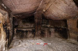
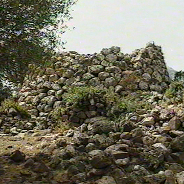
The nuraghe, of a mixed type, consists of a central tower with corridors around which three secondary towers have been built. The main tower, built on a rock outcrop, has an irregular plan (diam. NS m 14.50/EoM 12) and rises to a maximum remaining height of m 12 (in S). The tower is built with square granite ashlars arranged in regular rows. The entrance, trapezoidal (width m 0.80; height m 1.45), arched and with a drain compartment, leads into a trumped corridor - with a flat roof - which has a tunnel on the upper side, on which a well (prof. m 1.50) built with rows of small stones and covered with an ogiva opens. On the d. side, the main compartment opens in an elliptical shape (length m 2.80; width m 2) with a back cover and a rectangular niche (m 1.20 x 0.70). On the main wall of the central chamber, another corridor opens - with an elevated entrance - which leads to a stepped spiral staircase that leads to the upper floor. A circular tower is set up on the latter.
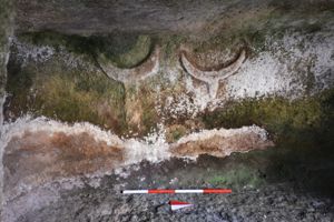
Three towers are added to the central keep, of which the one on the SE side (m 5.30 x 7.30) and the one on the N side (m 5.20 x 5.80) are cluttered with collapsing material. The third tower on the O side (m 8 x 7.80) has a rather complex internal planimetric development: two corridors open on the S side (width m 0.45; length m 3.00 - width m 0.50; length m 2.80), with architraved entrances, lead into a single elongated compartment (m 3.70 x 3.50). On the opposite northern wall of the room, another corridor opens (length m. 2.50 x m 0.60) that leads to the N side of the tower with an arched entrance. From the tower located on the O side, an antemural branches off an area of regular shape (12.50 x 9.80 m) in front of the entrance to the monument. All around the building, but with a higher density on the SE side, there are the remains of numerous huts, some of them of considerable size (diam. m 10).
History of excavations
It was the subject of an excavation carried out by the Superintendence for Archaeological Heritage of Sassari and Nuoro (1984).
Bibliography
A. Della Marmora, Voyage en Sardaigne ou description statistique, phisique et politique de cette ile avec des recherches sur ses productions naturelles et ses antiquités, II (antiquités), Paris, A. Bertrand-Torino, J. Bocca, 1840, p. 91;
V. Angius, in G. Casalis, Historical, Statistical and Commercial Geographical Dictionary of the States by H.M. the King of Sardinia, XIII, Turin, G. Maspero, 1840, p. 240; A. Taramelli, “Sheet 207: Nuova 207: Toro”, in Archaeological Edition of the Map 100,000 of Italy, 1, Florence, Military Geographic Institute, 1931, p. 32;
M.A. Fadda, Week of Cultural Heritage, 1975-1985:10 years of activity in the territory of the province of Nuoro (Nuoro 1985), Nuoro, Ministry for Cultural and Environmental Heritage, Archaeological Superintendence for the Provinces of Sassari and Nuoro, Nuoro Operations Office, 1996, p. 61.
How to get there
Exit from Orgosolo and head to the Montes forest barracks; once you reach the junction for Pratobello, turn right and continue for about 3 km. The nuraghe is located on a hill, beyond a dry stone wall, about 500 meters from a well-known restaurant and is not visible from the street.
Content type:
Archaeological complex
Archaeology
Usability: unmanaged site
Province: Nuoro
Common: Orgosolo
Macro Territorial Area: Central Sardinia
POSTAL CODE: 08027
Address: SP 2 bis - località Settile
Update
Where is it
Video

Comments