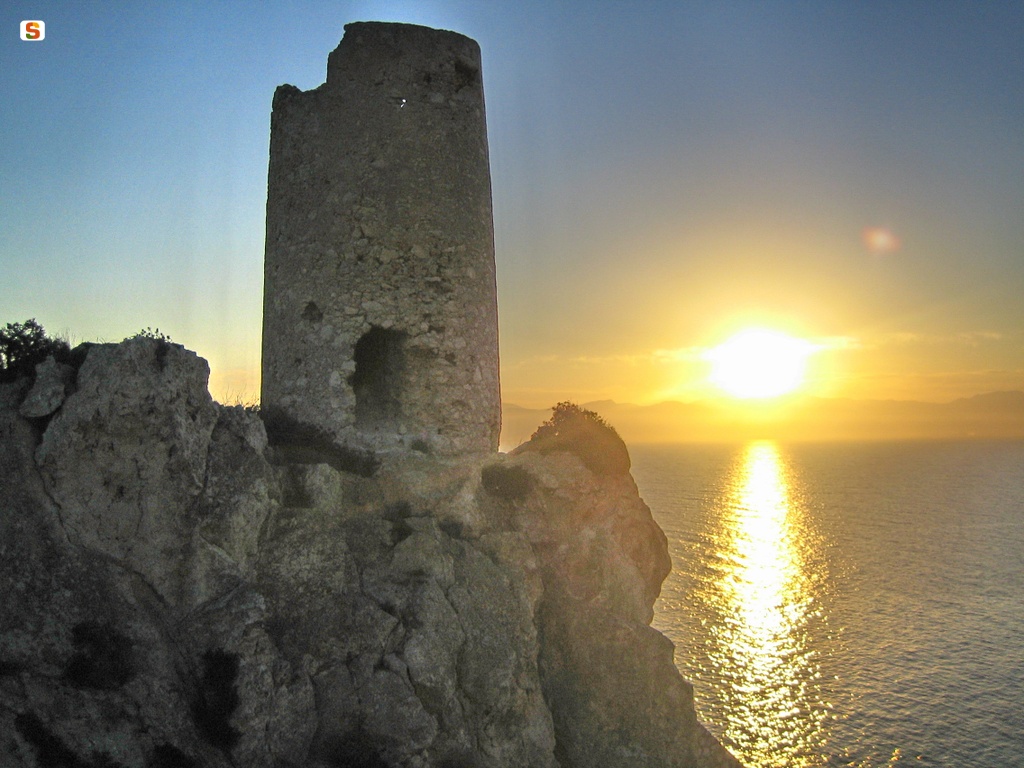
The tower guarded the entrance to the beach where there was a small port for the loading of minerals from the various mines in the area. From the fortress you can see the towers of Porto Paglia, Forte di San Vittorio, Isola Piana and Capo Pecora, where the “dead guard” (mobile lookout without a tower) was located in the town of Sa Guardia de Is Turcus.
The name of the fortress derives from the homonymous bay of Cala Domestica. The meaning of this toponym can perhaps be traced back to the presence of a medieval farm or 'domestic'.
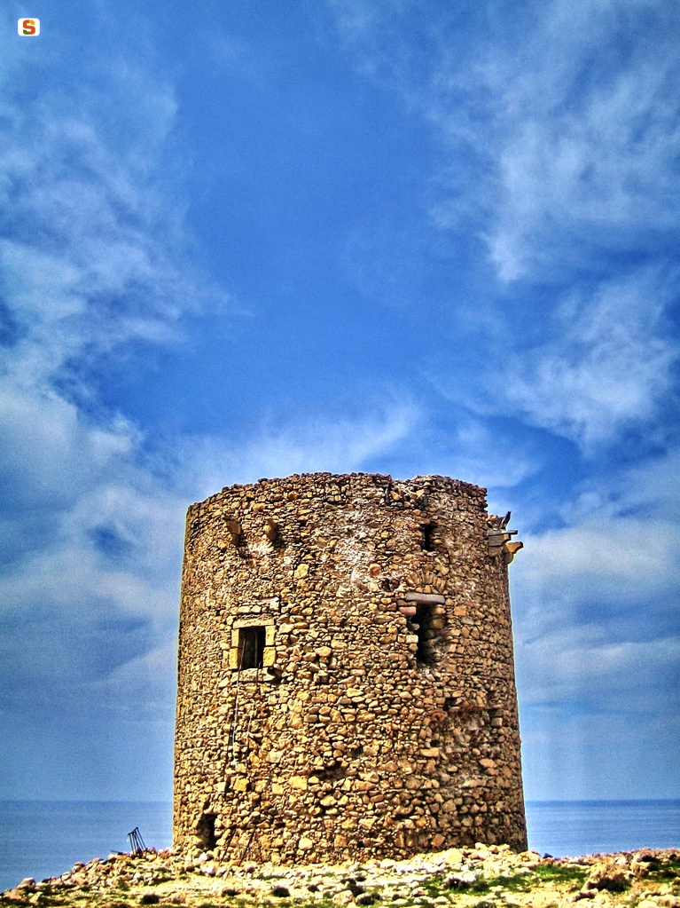
The date of construction of the tower appears uncertain, present in the architect Rocco Cappellino's charter, which dates it to 1577. However, the tower did not appear in subsequent reports, until 1798, when it was mentioned in the report by Viceroy Vivalda, on the budget and expenses of the Royal Administration of the Tower. According to this report, the tower in its state of design should have been called “Torre di Capo Pecora” or “Punta San Nicola”, or the tower of “San Nicolò”, because initially it was planned to build it on that promontory. Only when it was built on the promontory of Cala Domestica did it have its definitive name. Construction began in 1765, but it was not yet finished in 1777. Subsequently, work was prepared for the construction of the bastion according to the project of the engineer Daristo; in reality, due to the work poorly carried out by the entrepreneur Caredda, the structure had partially collapsed. Only after other interventions was the tower completed between 1785 and 1786.
The structure, made of limestone, has a cylindrical shape of about 12 m in diameter and 11 m high from the base to the pavement. The hatch, made of stone pebbles and lintels and a low-rounded draining arch, opened about 6 m above the ground, leads into a single domed chamber of about 7 m in diameter, in which the openings of the six troniers, that is, the slits and the access staircase, are arranged symmetrically. The room was ventilated thanks to an ventilation hole placed on the keystone of the room, now closed. There is also a fireplace and the tank hatch; the latter is accessible thanks to an opening in the basic masonry. In the parade ground (the external platform), remodeled during the Second World War when the fortress became an observation point, you can see the traces of gunboats and four boxes, also arranged symmetrically. Also outside, at the height of the roof, there are some shelves, built in tuff, that supported the defense scaffold.
Restorations from 1820 to 1831 are remembered. In 1843, the tower was still guarded. In World War II, it was an observation point. The iron staircase inside, still in place, dates back to that time.
Bibliography
F. Fois, Spanish Towers and Piedmontese Forts in Sardinia, Cagliari, The Sardinian Voice, 1981;
G. Montaldo, The coastal towers in Sardinia, Sassari, Carlo Delfino, Sassari 1992;
F. Russo, The coastal defense of the Kingdom of Sardinia from the 16th to the 19th century, Rome, Army General Staff, Historical Office, 1992;
M. Rassu, Guide to coastal towers and forts, Cagliari, Artigianarte, Cagliari 2000.
How to get there
The tower can be reached by the road that goes up from Buggerru to the village “Planu Sartu” and then continues to Cala Domestica. Or follow the path that leads from Gonnesa to Masua and Acquaresi. From here, walk along a river, up to the beach and walk up the promontory of Cala Domestica for about 300 m.
Content type:
Fortified architecture
Province: South Sardinia
Common: Iglesias
Macro Territorial Area: South Sardinia
POSTAL CODE: 09016
Address: SP 83 - località Cala Domestica
Update
Where is it
Video
Audio

Comments