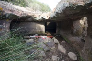
The monument is located on the edge of a plateau overlooking the valley where the Bardosu River flows, in the Marghine, a region of central-northern Sardinia.
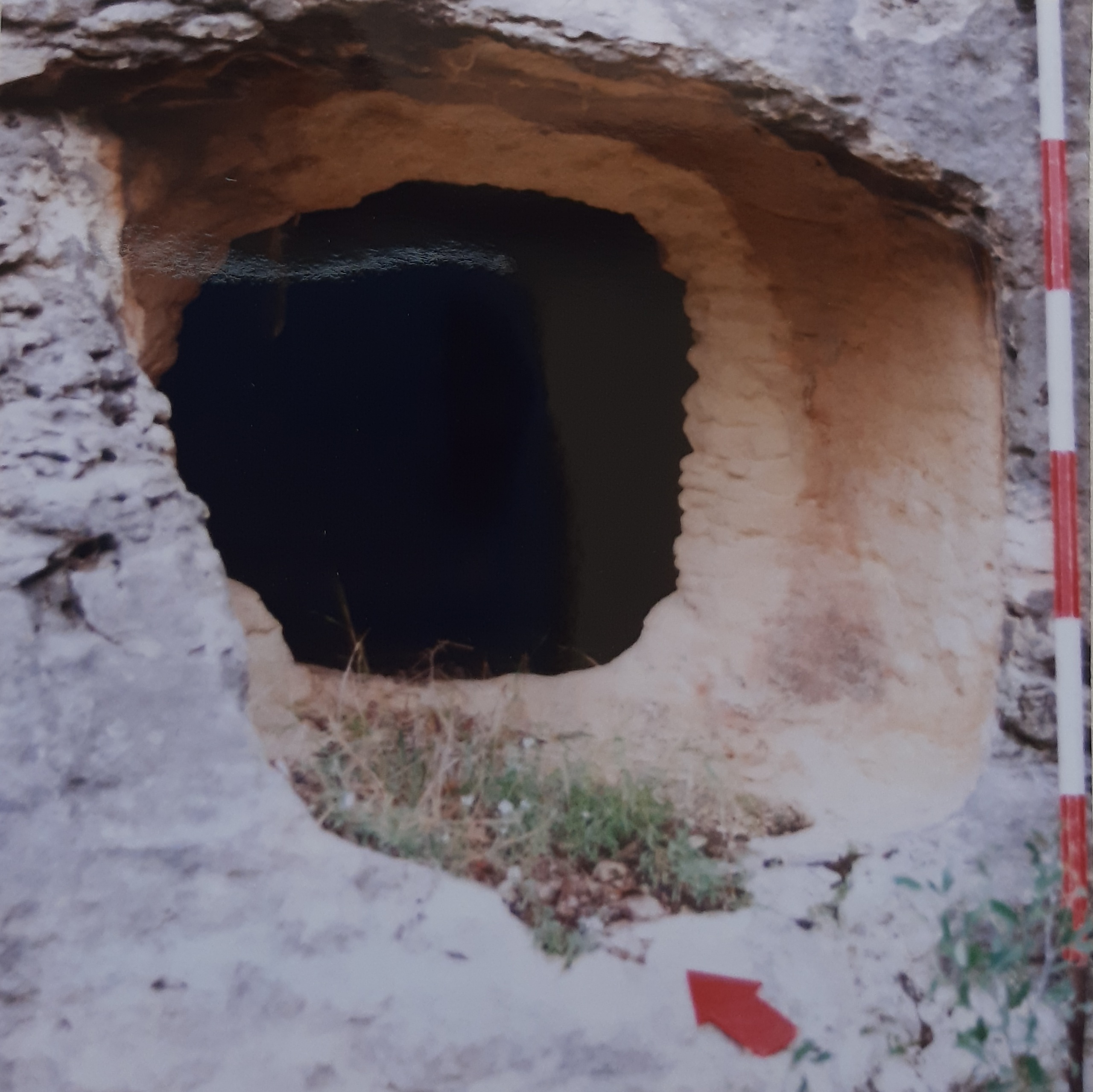
The nuraghe, a monotorre, preserves the room intact, expanded by three niches and preceded by an entrance gate to which the staircase and a niche open. A large village was attached to the monument, protected by an antewall. The tower, with a circular plan (diameter 14.00 m; height 9.30 m), is built with medium and large basalt blocks, worked and arranged in regular rows. The rectangular entrance (width 11.5 m; height 1.65 m) and oriented to SE, is surmounted by an architrave (width 1.10 m; thickness 0.95 m) with an exhaust window above (height 0.63 m). It introduces the entrance (length m 5.50; height m 2.20-4.30-3.60) which progressively widens and rises (width m 1.15-2.40-1.75) to the point where the openings of the staircase and a niche face, and then narrows in the direction of the room. The niche, located on the d side of the entrance, has a quadrangular plan (depth m 2.25; width m 1.95-1.05) and is preceded by an arched entrance (width m 1.95-1.50; height m 2.60). The stairwell (width 1.60 m), which opens on the left side of the gate, is now unusable due to the collapse. On the corridor ceiling there is an opening (diameter m 0.50) at the floor of an overlying polygonal compartment (m 1.75x1.85; height m 2.10); the compartment has an ovariate roof and is accessible from the central chamber. The entrance to the room is surmounted by an lintel (width 1.15 m; thickness 0.40 m) with an exhaust vent (height 0.50 m). The environment is circular in plan (diameter 4.50-4.75 m), has an intact vault (height 8.00 m) and has three niches: the niche s. shows a development on the right (depth m 4.15; width m 1.30/1.50); the central niche has a quadrangular plan (depth m 1.80, width m 1.30-1.90); the niche d. has a trapezoidal entrance (width m 1.65/0.65; height m 3.40) and a trapezoidal plan (depth m 2.00; width m 1.40/1.95). On the main wall of this last room, there is a rectangular opening (width 0.35-0.45 m; height 1.05 m) - raised by 3.50 m from the floor - which leads to a corridor (width m 0.89/1.00) that connects with an ogival compartment above the entrance. The nuraghe dates back to 1600-1000 BC.
The existence of a sacred well, recently covered, and a tomb of giants, a short distance from the nuraghe, has been reported.
History of excavations
The monument has been mentioned since the nineteenth century.
Bibliography
V. Angius, in G. Casalis, Historical-Statistical-Commercial Geographical Dictionary of the States by H.M. the King of Sardinia, II, Turin, G. Maspero, 1834, p. 406;
A. Della Marmora, Voyage en Sardaigne ou description statistique, phisique et politique de cette ile avec des recherches sur ses productions naturelles et ses antiquités, II (antiquités), Paris, A. Bertrand-Torino, J. Bocca, 1840, p. 106; Ministry of Education, List of Monumental Buildings, Rome, Tip. Operaia Romana Cooperativa, 1922, p. 75;
A. Taramelli, “Sheets 205-206: Capo Mannu-Macomer”, in Edition of the Archaeological Map of Italy 100,000, 16, Florence, Military Geographic Institute, 1940, p. 58;
A. Moravetti, “Ancient Settlements”, in Mountains of Sardinia, edited by I. Camarda, Sassari, Carlo Delfino, 1993, p. 179, fig. 92, n. 82; A. Moravetti, Archaeological Research in the Marghine-Planargia.
The Marghine - Monuments, Part One. Sassari, C. Delfino, 1998 (Archaeological Sardinia. Studies and monuments; 5), pp. 475-477;
A. Moravetti, Archaeological research in the Marghine-Planargia. The Planargia — Analysis and Monuments, Part Two. Sassari, C. Delfino, 2000 (Archaeological Sardinia. Studies and monuments; 5).
How to get there
From the SS 131, in the direction of Sassari, after the Macomer junction (km 158), turn right for Burgos and Bolotana. Continue until 45.5 km where there is a sign that indicates, on the left, the agrarian penetration road that leads near the nuraghe.
Content type:
Archaeological monument
Archaeology
Usability: unmanaged site
Province: Nuoro
Common: Bolotana
Macro Territorial Area: Central Sardinia
POSTAL CODE: 08011
Address: località Tittiriola
Update
Where is it
Video

Comments