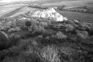
The archaeological area is located on the summit of the Trachitic Plateau of Monte Elias, in Anglona, a coastal region of northern Sardinia.
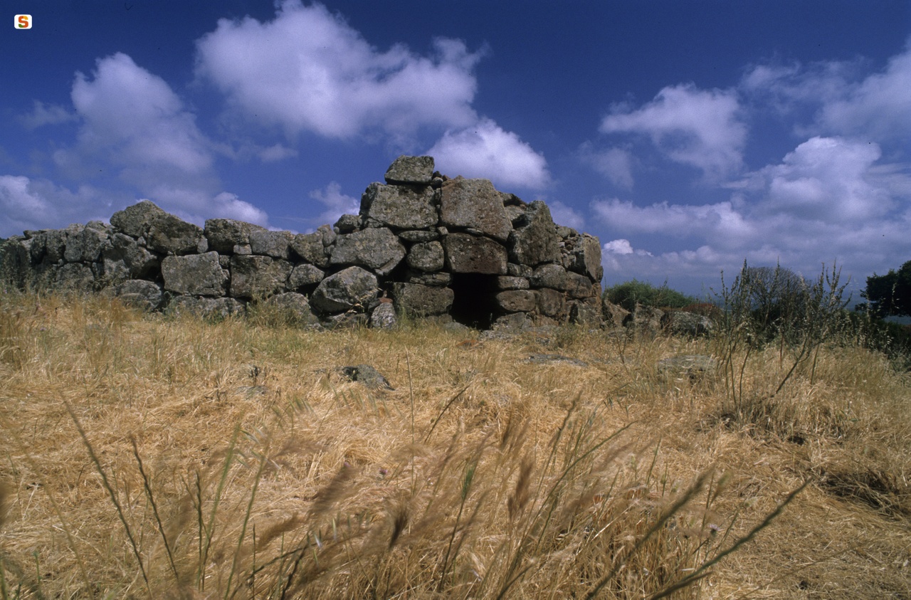
The complex consists of an extensive town defended by a wall. The curtain wall is preserved for a long straight-curved stretch (length 120 m; maximum height 5.00 m) built on the northern edge of the plank - not defended by steep walls - where the access path to the town opened. The wall is built with medium-sized stones arranged in fairly regular rows; several sections of different consistency remain: the best-preserved stretch is that of the northeastern end, where the wall takes on a curvilinear shape, perhaps at the same time as an embedded tower. In the middle sector, near the access path that goes up from the plateau below, the wall creates a “dead angle”, probably to protect the entrance to the acropolis.
Halfway up the slope below, there are the remains of a second, perhaps earlier, fortification built with large square blocks. The village stretches on the top of the plateau and has numerous huts; the area has returned some isolated orthostats and fragments of stone basins.
The complex dates back to 1400-1000 BC, but it was still frequented in Roman times, as evidenced by the discovery of ceramic materials and two funerary steles with a “mirrored face”, from the Punic tradition. One of the two steles depicts the face of the deceased, with a beard and mustache rendered with exceptional realism.
History of excavations
The complex was investigated in the last decades of the last century.
Bibliography
P. Melis, “Tergu, Monte Elias (Province of Sassari), in Journal of Prehistoric Sciences, XLII, 1-2, 1989-1990, 1990, p. 399; P. Melis, “Tergu. Nuraghi and Monumental Buildings”, in Gallurese Almanacco, 3, 1994-95, 1994, pp. 69-75;
P. Melis, “Two new steles with a 'mirror smile' from Tergu (SS)”, in New Sardinian Archaeological Bulletin, 5, 1993-1995, 2002, pp. 277-286.
How to get there
Reaching Tergu from Castelsardo or Sassari, continue to the Sanctuary of Santa Maria, cross it and then, 200 meters after an electric cabin, turn right on a municipal road that runs entirely to the end (after about 1.5 km), stopping in front of the height of Monte Elias, which you climb on foot around the opposite side (North).
Content type:
Archaeological complex
Archaeology
Usability: unmanaged site
Province: Sassari
Common: Tergu
Macro Territorial Area: Nord Sardegna
POSTAL CODE: 07030
Address: località Monte Elias
Update
Where is it
Images
Video
Author : Figus Ignazio

Year : 2008
Results 2 of 45017
View AllAudio
Comments