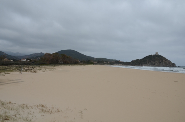
The archaeological area is located above and at the foot of the promontory of Torre di Chia, on the southern coast of Sulcis. Although the center was founded around 720 BC, the area chosen for the installation of the first housing structures shows the typical characteristics of settlements dating back to the pre-colonial phase of Phoenician navigation in Sardinia: a hill projected onto the sea, an excellent river port and an inland protected by the hills of Monti Sa Guardia.
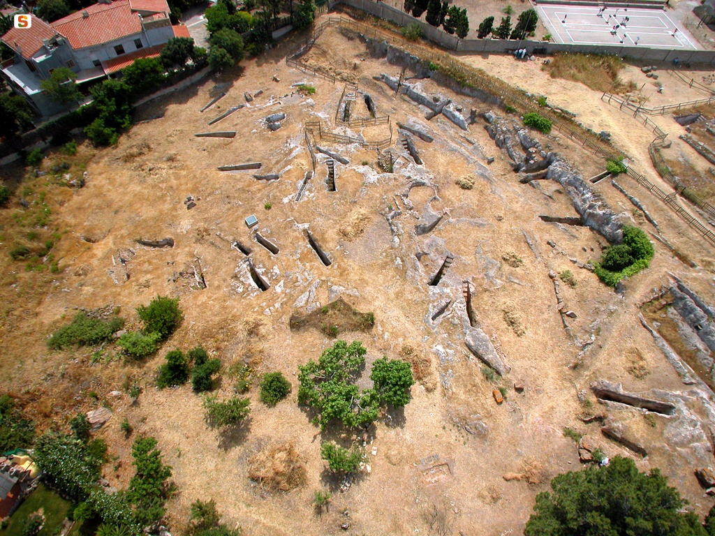
The ancient Phoenician city is known mainly thanks to the discoveries made in the area of the necropolis and the Tofet.
The necropolises, dating from the end of the 7th century BC to the last quarter of the 6th century BC, are located in the sandy coastal strip to the W of the promontory of Torre di Chia, the seat of the archaic settlement. In the vicinity, towards N, a sacred building was found, currently in the garden of a villa, with a late Punic monumental statue of the god Bes and an important Neopunic inscription from the early 3rd century AD. The latter made it possible to know the ancient name of the center (“Byt'n”) and to ascertain the persistence of the typical Punic judiciary of the suffetate still in the middle of the Roman imperial age.
The type of burials attests to the predominance of incinerations, both in a pit dug in the ground and in a stone cyst, although the practice of burial is also documented to a lesser extent.
The discovery of nuragic containers (some restored in ancient times with lead staples) is a clear symptom of the complex phenomenon of urbanization that affected the city community; just as the numerous ceramics imported with overseas traffic attest to the wide commercial horizons of the center.
In the following Punic Age, the so-called “cassone” tomb spread almost exclusively, with large stones arranged along the edge of the pits containing the individuals buried with related equipment. The analysis of the contexts has shown a sharp contraction of the center between the end of the 6th century BC and the first years of the 5th century BC, a phenomenon that can be traced back to the Carthaginian intervention in Sardinia. The sacred area of the Tofet was installed on the islet of Su Cardolinu, east of the acropolis, and near the mouth of the river port, around the last years of the 7th century BC; it ceased its function with the Carthaginian conquest of the island. In fact, the investigations carried out starting in 1964 have shown that around the first years of the 4th century BC, a sanctuary was built around the first years of the 4th century BC, in place of the previous Phoenician sacred area, with “peribolus” and foundations for the erection of cultic shrines.
The river port represented the pivot of all the economic activities that revolved around Bithia. It was created in the estuary following the deviation of the course of the Chia River, favored by cuts and construction of banks made to prevent the river from feeding the lagoon located behind the settlement.
In Roman times, the center, located along the road “quae a Nora ducit Bithiae”, was not very extensive; the community had to be divided into small groups in the territory, perhaps because of productive activities among which agriculture certainly should not have been predominant, given the small size of the hinterland.
The definitive abandonment of the settlement took place between the end of the 4th century BC and the beginning of the 5th century AD
History of excavations
The discovery of the cemetery area took place in 1926, following a violent storm, by Antonio Taramelli. The archaeologist carried out the investigations between 1928 and 1933. On that occasion, a strip of the archaic Phoenician necropolis and part of the Roman-era town were identified, currently visible at the beginning of the road that climbs up the hill to reach the tower.
In the early fifties of the twentieth century, Gennaro Pesce investigated the votive style of the Hellenistic age consisting of fictitious statuettes of suffering people.
Between 1976 and 1983, Piero Bartoloni conducted the systematic exploration of the necropolis for an area of about 500 m2.
Bibliography
P. Bartoloni, The Necropolis of Bitia - I, series “Collection of Phoenician Studies”, 38, Rome, C.N.R., 1996.
How to get There
From Cagliari, take the SS 195 in the direction of Pula. At the height of 46 km, at the crossroads, turn south to the town of Torre di Chia and follow the road to the intersection that coincides with the center of the tourist resort. The tower can be reached by turning to the S. of the same intersection.
Content type:
Archaeological complex
Archaeology
Usability: unmanaged site
Province: South Sardinia
Common: Domus De Maria
Macro Territorial Area: South Sardinia
POSTAL CODE: 09010
Address: viale del Porto, 21 - località Chia
Update
Where is it
Video

Comments