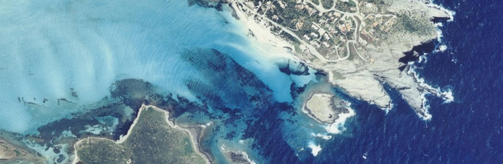
The name of the tower derives from the toponym of the area, 'La Pelosa', probably originally 'sa palosa' due to the strong presence of marine straw. The tower, 3 meters above sea level, controlled the Strait of Asinara and was in visual contact with the towers of Isola Piana and Capo Falcone.
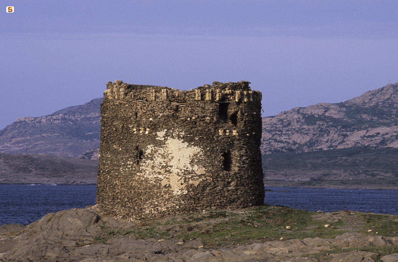
The tower, in shale, has a truncated conical shape with a base diameter of 16 m, a height of 10 m and a wall thickness of about 2.5 m. The hatch, which guaranteed access to the casematta, that is, the internal bombproof environment, is located about 6 m above the ground. This room, with a circular perimeter, has a mushroom vault with a central pillar and is divided into three rooms by partitions. In each of these spaces there is a troniera, that is, a slits. At the s of the entrance, inside the wall structure, there is the staircase that accesses the Piazza d'Armi, the outdoor terrace, on which other cannons were placed. In this environment, we can still recognize the remaining structures of the shovel, that is, of the parapet on the ground side, and part of the crescent, a structure made of rods and blocks, shaped like a semicircle, that protected the ammunition and the soldiers for the night.
The construction of the tower generally took place before 1578, the date of the report of the Viceroy De Moncada, in which there is already talk of the need to repair it.
In 1637, there was evidence of a galley attack from Bizerte and in December of the same year also by a French privateer naval team, who ended up destroying the towers of the entire N/O sector. Perhaps for these reasons, from archival documents, we can find that in 1637, in the Torre della Pelosa, there was a greater allocation of men and weapons.
Subsequently, the tower, after being repaired or rebuilt, was documented in 1720 in the report by Cagnoli, the First Commissioner of Factories, Artillery and Fortifications, where it was defined as a “tower of weapons”, that is, strong, of heavy defense. Later, in the 1767 report by the Piedmontese Ripol, the presence of the “warden” (the captain of the tower), an gunner and three soldiers, plus an armament consisting of a shotgun and three cannons, is witnessed in the tower. In addition, there are repairs in 1766, 1785-86, 1828 and 1841.
In 1842, the Royal Administration of the Towers was suppressed, an institution governed by a deliberative body, composed of the viceroy and three representatives of the parliamentary arms, which managed the defense and fortification of those stretches of the Sardinian coast that were not administered by cities and barons. Four years later, the tower was decommissioned.
History of studies
The tower is included in the main works on coastal fortifications in Sardinia.
Bibliography
E. Pillosu, The Coastal Towers in Sardinia, Cagliari, Tipography La Cartotecnica, 1957;
F. Fois, Spanish Towers and Piedmontese Forts in Sardinia, Cagliari, La Voce Sarda, 1981;
G. Montaldo, The Coastal Towers in Sardinia, Sassari, Carlo Delfino, Sassari 1992;
F. Russo, The Coastal Defense of the Kingdom of Sardinia from the 16th to the 19th Century, Rome, Army General Staff, Historical Office, 1992; G. Montaldo, “Forts and Coastal Towers”, in The Architectures
fortified buildings in central-southern Sardinia. Proceedings of the Study Day, Cagliari October 16, 1999;
M. Rassu, Guide to coastal towers and forts, Cagliari, Artigianarte, Cagliari 2000.
How to get there
You take the SP road to Stintino, leaving the tourist village to D. to head to Capo Falcone. After 4.5 km you reach Pelosa beach. The tower is located on a small islet in front of the beach. A boat is required to reach it.
Content type:
Fortified architecture
Province: Sassari
Common: Stintino
Macro Territorial Area: Northern Sardinia
POSTAL CODE: 07040
Address: località Isola della Pelosa
Update
Where is it
Images


Comments