Title
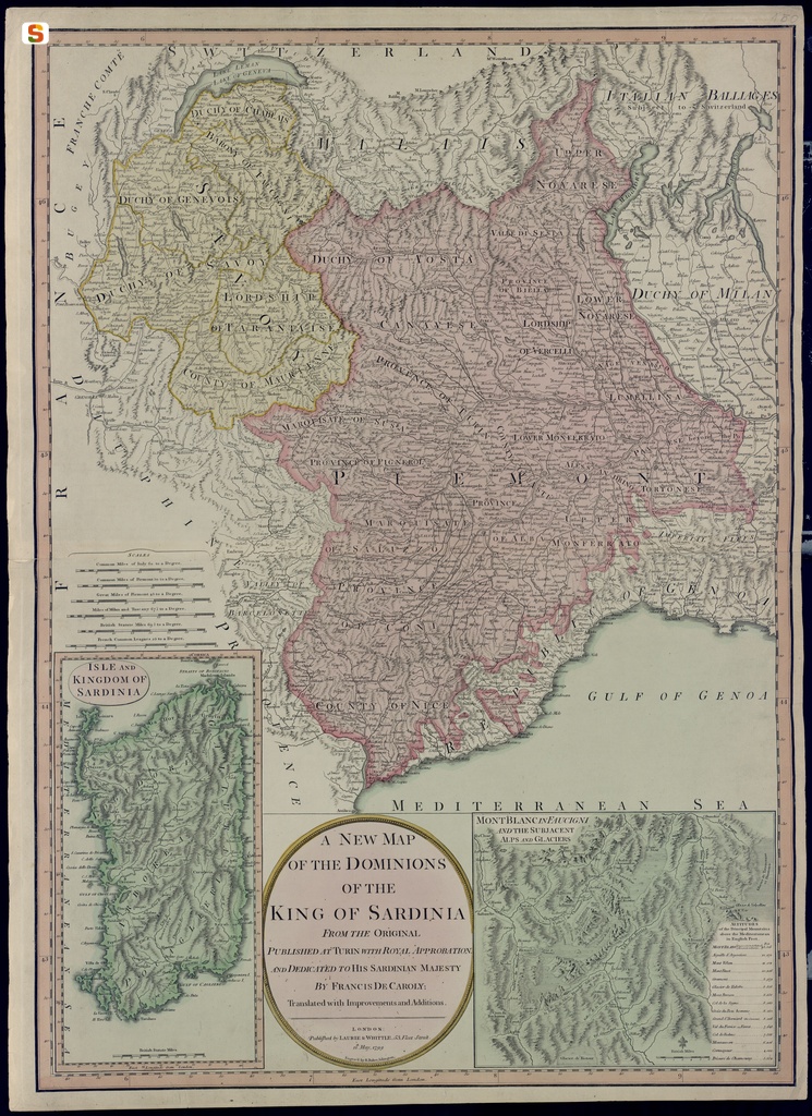
A new map / of the dominions / of the / king of Sardinia / from the origina! / published at Turin with royal approbation / and dedicated to his Sardinian Majesty / by Francis de Caroly; / translated with Improvements and Additions
Description
Nord in alto; dimensioni h x b foglio mm 726 x 530 R, incisione mm 720 x 521 R, disegno mm 699 x 505; Scales: Common Miles of Italy 60 to a Degree; Common Miles of Piemont 50 to a Degree; Great Miles of Piemont 45 to a Degree; Miles of Milan and Tuscany 67 1/5 to a Degree; British Statute Miles 69 1/2 to a Degree; French Common Leagues 25 to a Degree.Una scritta di seguito al titolo precisa che la carta è pubblicata a Londra presso gli editori Laurie & Whittle, attivi tra il 1794-1812. L'incisione è eseguita da Benjamin Baker (1766-1841). La carta riporta la data 12 May 1799, ma nella filigrana è ben individuabile la scritta 1813, che potrebbe riferirsi all'anno di produzione del foglio di carta. Sono rappresentati gli Stati di Terraferma del re di Sardegna, con l'aggiunta della Sardegna in un piccolo riquadro in basso a sinistra e un disegno del monte Bianco con l'indicazione delle altitudini delle vette principali in una cornice sulla destra. La carta generale e quella della Sardegna sono graduate ai margini. Sono inoltre riportate sei scale grafiche nella carta più grande, oltra a una nella Sardegna e una nel disegno del monte Bianco. La semiologia è quella tradizionale. Le regioni storiche appaiono delimitate da trattini e diversamente colorate. Una carta simile, dal titolo Savoy and Piemont with the Isle of Sardinia, stampata da Jones e Smith, incisori in Pentoville venne inclusa nel New English Atlas dello Smith, pubblicato nel 1801.

Comments