Subjects





The monument is located in the suggestive Moon Valley, in inner Gallura. It is located on a small plateau, near the Turrali River, and enjoys a wide visual view of the surrounding mountains and hills.
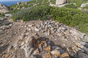
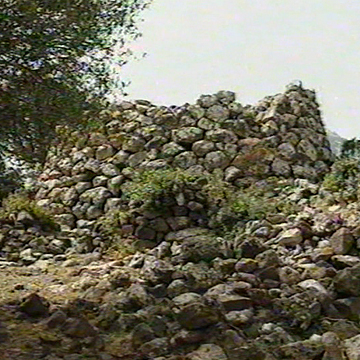
The Izzana nuraghe, one of the most interesting and best preserved in Gallura, is a mixed-type building, with construction characteristics typical of corridor nuraghes, quite common in this region of Sardinia, and typical elements of the “tholos” nuraghi: all built in a single construction moment. The tower has a triangular plan with rounded vertices (17.00 m x 20.30 m; height 7.45 m). It is built with irregular rows of huge granite blocks that have just been drafted and is rewrapped by additional masonry with rows of rough blocks. Access to the monument is through two entrances: the first, the main one, open on the south side (width 1.00 m), leads into a short cordoned and flat path (length m 2.40; width m 1.00/1.40) that leads directly to the chamber at “tholos”; the second, facing west (width m 1.20), leads into a long corridor with an angular roof (length m 6.40; width m 1.00) that, with a narrowing in the middle of the path, turns right until it reaches the chamber. On the left wall of this connecting compartment, at a distance of m 2.00 from the external entrance, the entrance to a second corridor (width m 1.00) obstructed by the collapse opens. The second corridor originally led, by means of a staircase, to four flat banded cells made in the northern part of the monument on a higher level. The central chamber (diameter 5.25 m; height 7.00 m) is built with large and medium-sized rough blocks, arranged in regular and projecting rows until the irregular warhead is closed. The articulation of the rooms on the upper floor appears to be quite complex. A staircase, now filled with collapse, with an entrance to the corridor now interrupted, led into a flat corridor (residual length m 7.40; width m 1.20) that has the entrances to two corridors on the right wall: the first (length m 4.40; width m 1.00), flat, has an oblique development, while the second, shorter and slightly trumped (length m 3.00; width m 1), leads to an irregular cell (m 3.00 x m 4.00 m) turned over the warhead.
This small room has on the left wall the opening of a compartment (width m 1.20) with a curvilinear development, now interrupted, and the entrance to a straight flat corridor (length m 5.00; width m 1.00) that leads to the outside with a narrow tunnel (width m 0.40). Facing this corridor, another shorter corridor, always flat, opens on the right (length m 4.00; width m 1.10). The 'labyrinthine' aspect of this building has suggested the idea of a 'nuraghe-trap', destined to disorient the attackers.
The nuraghe can be dated between the end of the ancient Bronze and the Final Bronze.
History of excavations
The nuraghe dates back to the first decades of the last century.
Bibliography
A. Taramelli, “Sheets 181-182, Tempio Pausania (Terranova Pausania)”, in Archaeological Edition of the Map of Italy, Florence, Military Geographic Institute, 1939; G. Lilliu, The Nuraghi.
Prehistoric Towers of Sardinia, Cagliari, La Zattera, 1962, p. 141 (with previous bibliography);
M. L. Ferrarese Ceruti, “Types and Forms of Doors and Windows in the Nuraghi”, Proceedings of the XIII Congress on the History of Architecture (Sardinia), (Cagliari, 6-12 April 1963), I, Rome, Center for Studies for the History of Architecture, 1966, pp. 101-118; M. L. Salis, “Tempio Pausania.
Nuraghe Izzana”, in Archaeology of the Territory. Territory of Archaeology, Sassari, Carlo Delfino, 1996, pp. 367-368.
How to get there
Take the SP 74 road from Aggius to Trinità d'Agultu, up to Km 2.2, then turn right into a road with a natural background marked by the Nuraghe Izzana tourist sign. After 1.3 km, turn right, on a rather rough path, indicated by a wooden sign and near a gate; you proceed by car for about 1.4 km (passing the various gates of the estates crossed by the path) until you reach the nuraghe. If you come from Viddalba or Trinità d'Agultu, the entrance to the dirt road is located at km 7.5 of the SP 74; you walk it for 3 km until you find the path that leads to the nuraghe on the left.
Content type:
Archaeological monument
Archaeology
Usability: unmanaged site
Province: Sassari
Common: Tempio Pausania
Macro Territorial Area: Nord Sardegna
POSTAL CODE: 07029
Address: SP 74 - località Izzana
Update
Where is it
Images
Video


 Facebook
 Twitter
 LinkedIn
 Whatsapp

 Print
Print
 E-mail



Comments