Subjects





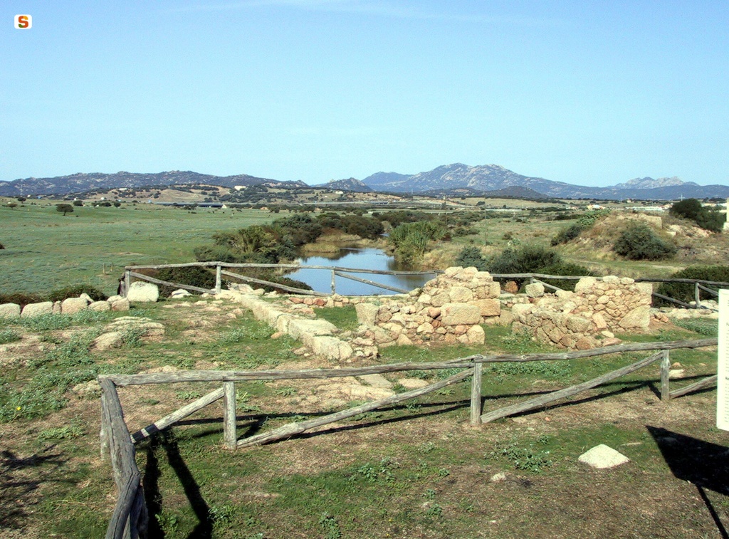
The archaeological area is located on a small hill, on the right bank of the Padrogianus river, a few kilometers from the mouth, near the Gallura coast.
The complex, heavily damaged in the northern and eastern parts due to the opening of a railroad and the construction of the provincial road, covers an area of about 1000 square meters.
It looks like a large quadrangular structure (33 x 30 m on the side), with about twenty rooms organized around a central courtyard partially occupied by a square building (9 m on the side).
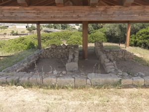
The walls are built with blocks of local granite and ashlar cut at more or less regular intervals (“opus africanum”); in some cases part of the rise has been preserved in raw bricks.
The floors are made with thin layers of cocciopesto and in some rooms with irregular pavements.
Rooms II and V have returned a series of artifacts, including a press and tanks (“calcatoria”) connected with the production of wine. A considerable number of fragments of transport amphorae come from a contiguous environment (VI). The space certainly represents the warehouse for storing products.
In two other connecting rooms (I and IV), located in the southern part of the complex, the basalt fragments of a 'meta', of a 'catillus' and of a 'manual grindle' have been found. It can therefore be assumed that in these environments the activities of processing cereals for the production of bread were carried out.
The central square building has some modest rooms inside. The small building, equipped with an independent kitchen with a terracotta oven very similar to the “tabouna” still widespread in Tunisia, had an upper floor; above it there was probably a terrace that allowed the entire complex and part of the surrounding area to be controlled.
The structure of S'Imbalconadu was built at the end of the second century BC; the abandonment was instead determined by a series of traumatic events (fires, depredations) placed before the end of the first quarter of the first century BC.
Scholars interpret the complex as a farm oriented to the management of a “fundus”. The central building was perhaps the home of the farm's owner. The findings attest that the farm practiced, in addition to the cultivation of cereals, various collateral activities such as livestock and hunting (bones of sheep, pigs and, to a lesser extent, cattle). Wine production was aimed at self-consumption, but market activities could also be practiced, given the proximity of the port city.
Within the territory of Olbia, the S'Imbalconadu farm is part of an organic framework of employment and exploitation set up by the government of Rome. According to archaeologists, this exploitation was carried out through various large plants, such as the one investigated, accompanied by a more or less dense network of service homes. About thirty sites that seem to show a single moment of foundation during the Republican period. A shirt that was gradually abandoned during the imperial period, when probably, as in other parts of the island, the system was replaced by large late-imperial villas, connected to large estates and operating on a large scale with slave labor.
The structures and size of S'Imbalconadu's farm, in this diachronic process of occupying rural spaces, could represent a sort of intermediate link. In its implantation phase, it is not excluded that this model, even if borrowed from the Italian ones, made use of local labor of Punic or Sardinian-Punic origin, who took over the direction of agricultural activities. A class still linked to pre-Roman organizational, constructive and cultural traditions, as evidenced by construction techniques and some finds: among these, a granite stele bearing the Punic sign of Tanit, found in the central square building.
History of excavations
The structures, known since the seventies of the twentieth century, were excavated in the following decade.
Bibliography
A. Sanciu, “A Roman farm from the Roman age in the countryside of Olbia”, series “Publications of the Department of History of the University of Sassari”, 32, Sassari, 1997, p.224.
How to get there
The archaeological complex can be reached, from the town, in the S direction for about 3 km along the SP24 road to Loiri.
Content type:
Archaeological monument
Archaeology
Usability: unmanaged site
Province: Sassari
Common: Olbia
Macro Territorial Area: Nord Sardegna
POSTAL CODE: 07026
Address: SP 24, località Ponte Loddone
Update
Where is it
Images
Audio


 Facebook
 Twitter
 LinkedIn
 Whatsapp

 Print
Print
 E-mail

![[Olbia, Sassari], località S'Imbalconadu : scavo di una fattoria](data:image/png;base64,iVBORw0KGgoAAAANSUhEUgAAAAEAAAABCAQAAAC1HAwCAAAAC0lEQVR42mNkYAAAAAYAAjCB0C8AAAAASUVORK5CYII=)

Comments